1941 Wartime Tourist Map of the City of Charlottetown, P.E.I.
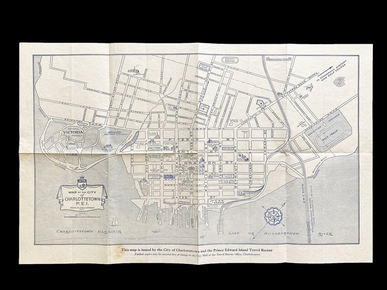
Charlottetown, P.E.I. City of Charlottetown & P.E.I. Travel Bureau, 1941. First Edition. Map. Wartime issued tourist map of the City of Charlottetown, P.E.I. Map scale is 400 feet to 3/4 inch and is printed in blue ink onto white paper, issued folded for use as a pocket map and measures 13-7/8 tall x 22 inches wide. Interesting features shown are the Experimental Farm, the toll-free Hillsborough Bridge, RR stations, the Masonic Hall, Yacht Club, etc. Map with some toning and a single stain in bottom margin, else clean and unmarked. At Least Very Good. Item #3821
Scarce in the 1941 first edition (likely due to wartime paper shortages) this popular map was reprinted in 1949, 1954, then revised in 1961 and reprinted many times thereafter.
Price: $115.00 CAD other currencies