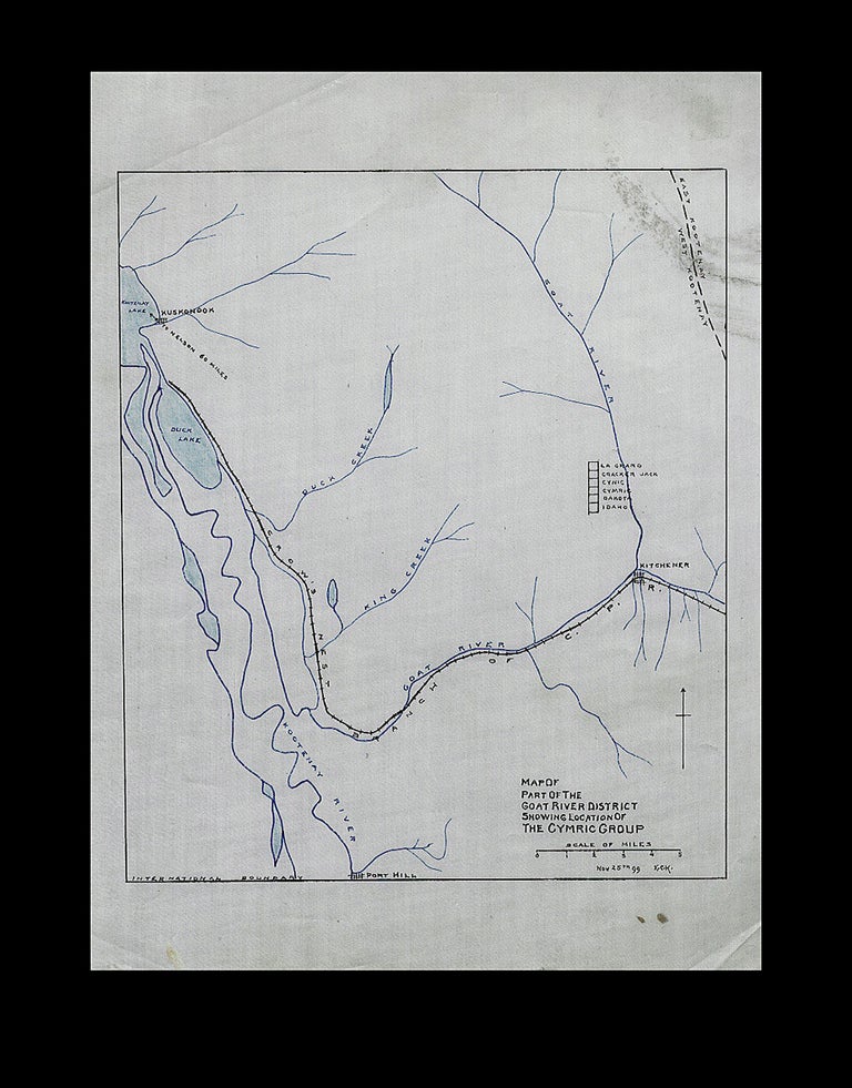
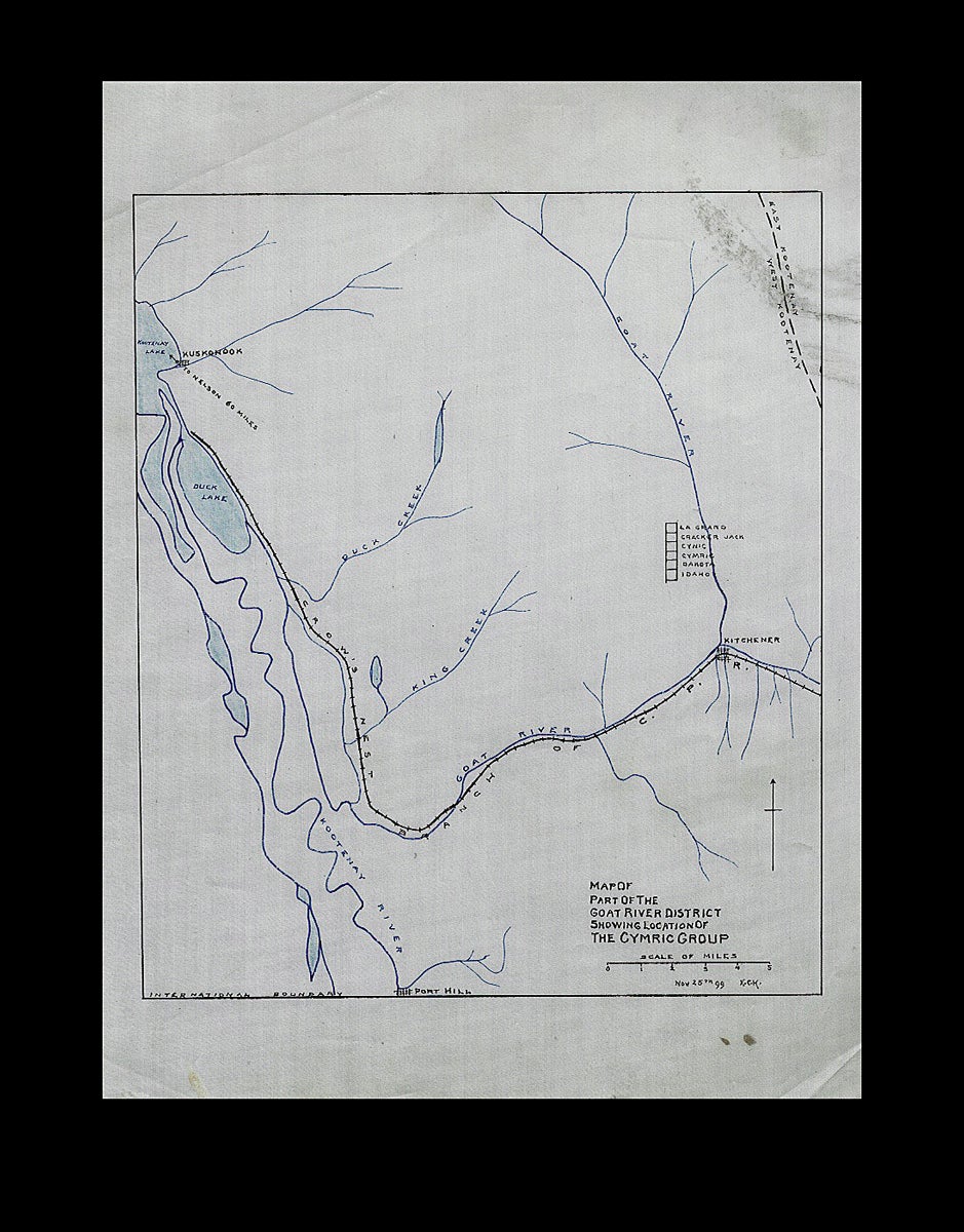
Map of Part of the Goat River District Showing Location of the Cymric Group - 1899
1899. Loose Map. An historic hand-colored map on linen, showing six early mining claims in south east British Columbia. Pen and ink with wash color on coated drafting linen, "Nov. 25th 99" and "E.C.H." at bottom right "International Boundary" written at lower left, map measures 9-1/8 inches tall x 7-3/4 inches wide to neat line, overall sheet size is 11-3/4 x 8-3/4 inches wide. Details show the Crow's Nest Branch of the C.P.R., the paddlewheeler landing at Kuskonook with an arrow pointing "To Nelson 60 Miles", the Port Hill border crossing, Kootenay and Goat Rivers, numerous creeks, the town of Kitchner and six different mine claims ; the La Grand, Cracker Jack, Cynic, Cymric, Dakota and the Idaho. Map with a few soil marks and light creases, else fine. Near Fine. Item #3781
This region is now highly developed with a multitude of additional mining claims surrounding the map claims area.
Price: $150.00 CAD other currencies