![Item #2902 [East Kootenay, B.C.] 1897 Map of Fort Steele Mining Division. Thos. T. McVittie.](https://harropianbooks.cdn.bibliopolis.com/pictures/2902.jpg?width=768&height=1000&fit=bounds&auto=webp&v=1615338476)
![[East Kootenay, B.C.] 1897 Map of Fort Steele Mining Division](https://harropianbooks.cdn.bibliopolis.com/pictures/2902_2.jpg?auto=webp&v=1615338476)
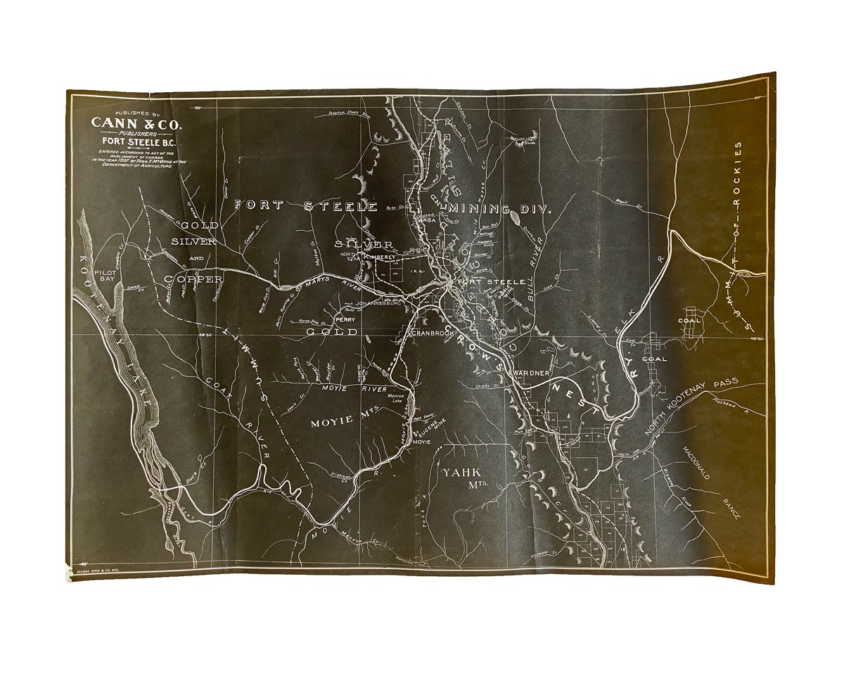
[East Kootenay, B.C.] 1897 Map of Fort Steele Mining Division
Winnipeg, MB: Cann & Co., 1897. Loose Map. A photo reproduction [period unknown and likely reduced in size] of a very uncommon, and early black print map of the Fort Steele Mining Division, measuring 10-5/16 inches tall x 14-13/16 inches wide at neat lines. Map shows great details of various mines and mining properties with vertical relief shown by hachures. "Bulman Bros & Co. WPG." is printed at bottom left. Map is slighty curled near edges w. 2 vertical creases, a corner crease to upper right corner and a single 1/4 inch closed tear to upper edge near left corner. Near Fine. Item #2902
Area covered by the map includes from Kootenay Lake to Crow's Nest Pass and Contact Creek to the International Boundary at the 49th parallel.
Price: $200.00 CAD other currencies