![Item #4021 [Road Maps] Motor Roads to The Canadian Rockies - 1923. A. S. Dawson, G. Laing.](https://harropianbooks.cdn.bibliopolis.com/pictures/4021.jpg?width=768&height=1000&fit=bounds&auto=webp&v=1651347743)
![[Road Maps] Motor Roads to The Canadian Rockies - 1923](https://harropianbooks.cdn.bibliopolis.com/pictures/4021_2.jpg?auto=webp&v=1651347301)
![[Road Maps] Motor Roads to The Canadian Rockies - 1923](https://harropianbooks.cdn.bibliopolis.com/pictures/4021_3.jpg?auto=webp&v=1651347301)
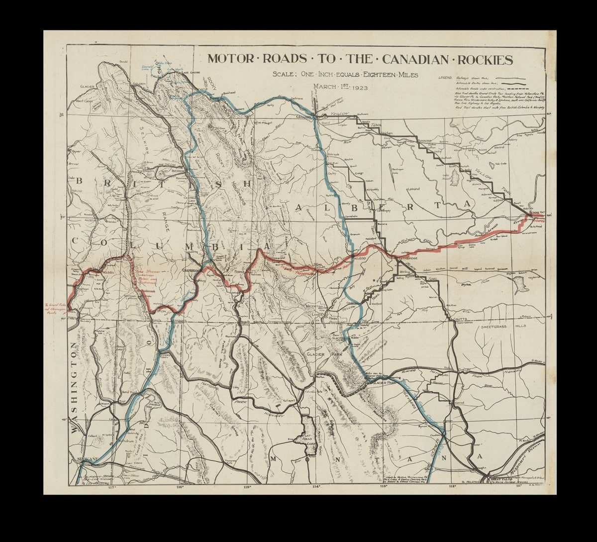
[Road Maps] Motor Roads to The Canadian Rockies - 1923
Fernie, BC: The Tourist Association of South-Eastern B.C and Southern Alberta ; Calgary Good Roads Association ; Calgary Auto Club, 1923. Paperback. Main map title. Map folder cover title is "Auto Road Maps of The Scenic Heart of the Canadian Rockies, South Eastern British Columbia & Sunny Southern Alberta with The Banff-Windermere Road - A Paradise for Motorists, Anglers, Huntsmen and Health & Vacation Seekers". Folder holds three maps printed in three colors onto a single double-sided sheet measuring 18 x 16-1/2 inches wide. On the verso is a map centered on the Canadian Rockies, illustrating the "Auto Circle Tour of the Canadian Rockies" and a second map showing the "Grand Circle Tour" which stretches from Los Angles to Banff. Relief shown by hachures. Map folder w. toning, soil and small stains, red pencil date notation in upper right corner, some underling denoting which campgrounds are "Free", brief splits at head and tail of map folder spine fold. Maps are fine w. some toning and an insignificant crease where glued to folder. At Least Very Good. Item #4021
An early motoring map, with OCLC locating just a single copy, held at U of A. It is interesting to note that there were just over 30,000 registered motor vehicles in BC in 1923*, and thus, it's unlikely that a great number of these maps were originally printed or retained. *Circular No. 6 The Highway, the Motor Vehicle and the Tourist in Canada. The Highways Branch, 1925.
Price: $575.00 CAD other currencies