![Item #3782 [Manuscript Map] Bulah Fraction Mineral Claim Kootenay Dist. B.C. - 1905. F. C. Greely, P. L. S.](https://harropianbooks.cdn.bibliopolis.com/pictures/3782.jpg?width=768&height=1000&fit=bounds&auto=webp&v=1620843610)
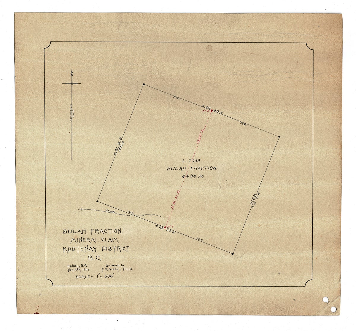
[Manuscript Map] Bulah Fraction Mineral Claim Kootenay Dist. B.C. - 1905
Nelson, BC: 1905. Loose Map. Located 20 k. east of Crawford Bay on Kootenay Lake and now mapped as "DL 7359 BULAH FRACTION MC", this appears to be a non-working claim. The perimeters of the claim are marked with the location coordinates and an unnamed creek is located flowing from bottom left corner of claim. Original manuscript mining claim map drawn with pen & ink onto heavy textured card, 8-3/8 inches tall x 9-3/16 inches wide to neat lines, sheet measures 10-3/8 x 11-3/16 inches wide, north arrow is indicated and scale is shown as 1"-300'. Map is toned with some creases and soil, punch holes to lower right corner, a few pin holes noted w. some soil, small stains and "Bulah" written in black ink 2x verso. Very Good. Item #3782
We were unable to locate any historical records of any work having been done on this claim, so obviously - - - this wallflower mining claim is still awaiting a suitable dance partner to come and sink a shovel into their next Eldorado!
Price: $85.00 CAD other currencies